Caminata por la belleza natural de Hong Kong
8 rutas de senderismo que debes visitar en Hong Kong
Resumen
Hong Kong es una ciudad conocida por sus imponentes rascacielos, sus calles animadas, sus excelentes tiendas y su increíble gastronomía. Pero Hong Kong tiene mucho más que ofrecer. Lo que la gente suele pasar por alto cuando visita Hong Kong son las numerosas rutas de senderismo y lo que estas tienen para ofrecer. Tanto si buscas una caminata relajante y pintoresca como si buscas algo muy desafiante, hay algo para ti.
Paseo circular por el pico Victoria
🌋 Dificultad: Fácil | Distancia: aprox. 3,5 km | Duración: < 1 hora
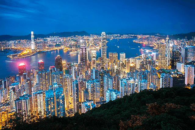
El paseo circular por el pico Victoria es probablemente la caminata más fácil y accesible de Hong Kong. El sendero da una vuelta alrededor del pico Victoria, uno de los monumentos más emblemáticos de Hong Kong. El sendero completo es relativamente corto, de apenas 3,5 km y solo unos 100 m de pendientes. Probablemente puedas considerarlo unacaminarEn lugar de una caminata, el sendero se puede completar en aproximadamente una hora. No solo es fácil y corto, sino que también obtendrá algunas de las mejores vistas del horizonte de la ciudad en este sendero, lo que lo convierte en una opción perfecta para aquellos que buscan simplemente quemar algunas de sus calorías después de darse un atracón de la increíble comida que Hong Kong tiene para ofrecer. Dado que el sendero es un bucle, puede ir en cualquier dirección y lo llevará de regreso al mismo lugar.
🗺️ **Ruta: **Peak Galleria → Lugard Road → Harlech Road → Peak Galleria
🚆**Cómo llegar:**Tome el Peak Tram desde la terminal inferior del Peak Tram, a 10 minutos de la estación central de MTR. O tome el autobús n.° 15 desde la terminal central de autobuses. O simplemente camine hasta Victoria Peak desde la estación central de MTR (aproximadamente 60 minutos)
Ruta geológica del embalse de High Island
🌋 Dificultad: Fácil | Distancia: aprox. 4,3 km | Duración: 3 horas
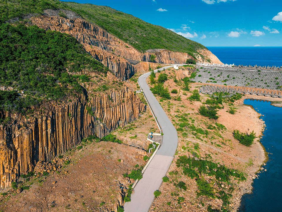
El sendero geológico del embalse de High Island es otra pintoresca caminata que lo lleva alrededor del embalse más grande de Hong Kong. El sendero geológico tiene solo 4,3 km y es parte del sendero MacLehose de 100 km que va desde Sai Kung hasta Tuen Mun. Este sendero ofrece vistas impresionantes del embalse, así como de las montañas y bosques circundantes. A lo largo del camino, también verá uniones de columnas hexagonales de toba volcánica, cuevas marinas y farallones marinos formados durante los últimos siglos. Por supuesto, si está preparado para algo más desafiante, no dude en extender su caminata para cubrir más del sendero MacLehose.
🗺️ **Ruta:**Presa oriental del embalse de High Island → Biu Tsim Kok → Columnas de roca hexagonales → Cinturón de brechas de falla → Columnas de roca distorsionadas → Cueva marina
🚆 **Cómo llegar:** Tome el autobús 92 desde la salida C2 de la estación MTR Diamond Hill hasta Sai Kung Town. Desde Sai Kung, tome el minibús 9A desde Pak Tam Chung o tome un taxi hasta la presa este del embalse de High Island.
La espalda del dragón
🌋 Dificultad: Fácil - Intermedia | Distancia: aprox. 8,5 km | Duración: 4 horas
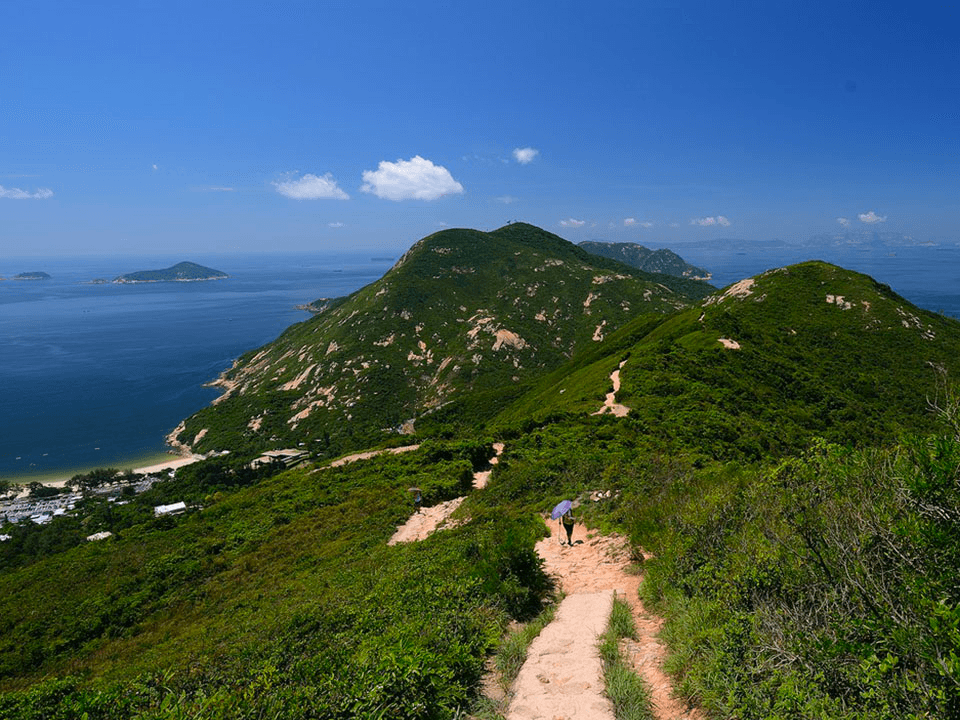
Este sendero de 8,5 kilómetros desde el mirador de la península de Shek O hasta la playa de Big Wave Bay es, sin duda, la ruta de senderismo más popular de Hong Kong. Se tarda aproximadamente 4 horas en completarlo y, aunque hay algunas pendientes pronunciadas, la mayoría de las personas no deberían tener problemas para completarlo. El sendero atraviesa bosques frondosos, crestas escarpadas y playas de arena. Lo más destacado de la caminata es, sin duda, la vista panorámica de la playa de Shek O, la bahía de Big Wave y el mar de China Meridional.
🗺️Ruta: Mirador de la península de Shek O → Pico de Shek O → Dragon’s Back y Pottinger Gap → Bahía Big Wave
🚆 **Cómo llegar: **Desde la salida A3 de la estación Shau Kei Wan de MTR, camine hasta la terminal de autobuses de Shau Kei Wan. Tome el autobús 9 o el minibús rojo con el cartel "Shek O" hasta la parada To Tei Wan en Shek O Road.
Montaña Tai Mo
🌋 Dificultad: Intermedia | Distancia: aprox. 4 km | Duración: 2 horas
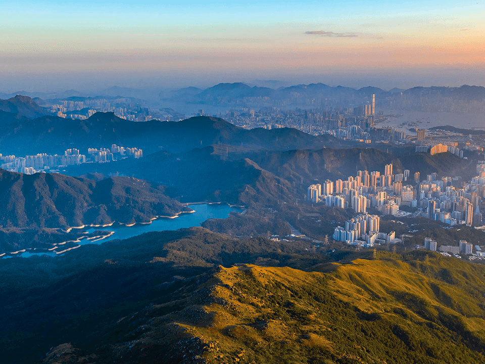
Hay varias rutas que pueden llevarte hasta una altitud de 957 metros sobre el nivel del mar en la montaña más alta de Hong Kong. La cima de Tai Mo Shan está vallada, pero hay muchos lugares cerca de la cima que son perfectos para ver la puesta de sol en medio de un mar de nubes, si el clima lo permite. Todos los senderos tienen diferentes dificultades, y la mayoría de la gente intentará ir por la Sección 8 del MacLehose Trail para su caminata hasta Tai Mo Shan. Pero si estás buscando algo que sea relativamente más fácil y bueno para familias, ve por el sendero que comienza en Rotary Park y pasa por el Centro de Visitantes del Country Park. Este sendero tiene aproximadamente 4 km y es relativamente seguro, a pesar de algunas pendientes pronunciadas a lo largo del camino.
🗺️Ruta: Rotary Park → Centro de visitantes del parque rural Tai Mo Shan → Tai Mo Shan Road y mirador Tai Mo Shan → Estación de radar meteorológico
🚆**Cómo llegar:**Camine hasta la parada de autobús en Tai Ho Road North desde la salida A de la estación MTR Tsuen Wan. Tome el autobús 51 hasta la parada Country Park, donde encontrará la entrada en Tai Mo Shan Road.
Sendero del pico Lan Tau
🌋 Dificultad: Intermedia | Distancia: aprox. 6 km | Duración: aprox. 4 horas
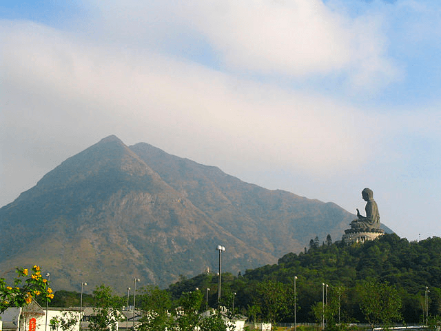
La isla de Lantau es más conocida por su centro comercial Citygate Outlet Mall y establecimientos budistas como el Monasterio Po Lin, el Buda Tian Tan y el Camino de la Sabiduría. Pero la isla de Lantau también es el hogar de una de las mejores caminatas de Hong Kong. En lugar de tomar el teleférico hasta la cima para ver el Gran Buda, ¿por qué no considera subir caminando? El pico de Lantau es el segundo pico más alto de Hong Kong, justo después del Tai Mo Shan. Del mismo modo, hay varias rutas para subir a la cima, cada una con su propio nivel de dificultad. Una de las rutas más fáciles y populares para subir a la cima será la Sección 3 del sendero Lantau, que es parte del sendero Lantau más largo de 70 km que atraviesa toda la isla. La Sección 3 del sendero Lantau comienza en Pak Kung Au y termina junto al Gran Buda en Ngong Ping. La ruta tiene muchos escalones y es bastante empinada, pero obtendrá vistas increíbles de la isla y el aeropuerto cercano mientras camina hasta la cima. El pico Lantau también se ve muy diferente en las distintas estaciones, por lo que es posible que quieras considerar subir a la cima por senderos diferentes en diferentes estaciones.
🗺️Ruta: Pak Kung Au → Pico Lantau → Camino de la Sabiduría → Monasterio Po Lin y Buda Tian Tan
🚆**Cómo llegar:**Dirígete a la terminal de autobuses desde la estación MTR Tung Chung, salida B, toma el autobús 3M o 11 hasta la parada de autobús Pak Kung Au.
Sendero MacLehose
🌋 Dificultad: Difícil | Distancia: 100 km | Duración: ~6 días
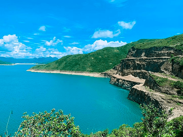
Si te apetece algo aventurero, el MacLehose Trail es una aventura de senderismo de 100 kilómetros que te llevará por Hong Kong. Para completar todo el recorrido a un ritmo pausado, una persona media tardará unos 6 días, aunque es posible completarlo en menos tiempo si estás en forma. Este sendero se divide en 10 secciones, cada una de las cuales ofrece sus propios desafíos y recompensas. Las secciones 2 y 4 son las que se consideran las más difíciles de recorrer. El MacLehose Trail consta de otros senderos más cortos, como el High Island Reservoir Geo Trail y el Tai Mo Shan Trail, que puedes plantearte hacer si los 100 km completos son demasiado intensos para ti.
Pico Kowloon y acantilado suicida
🌋 Dificultad: Difícil | Distancia: aprox. 5 km | Duración: aprox. 2,5 horas
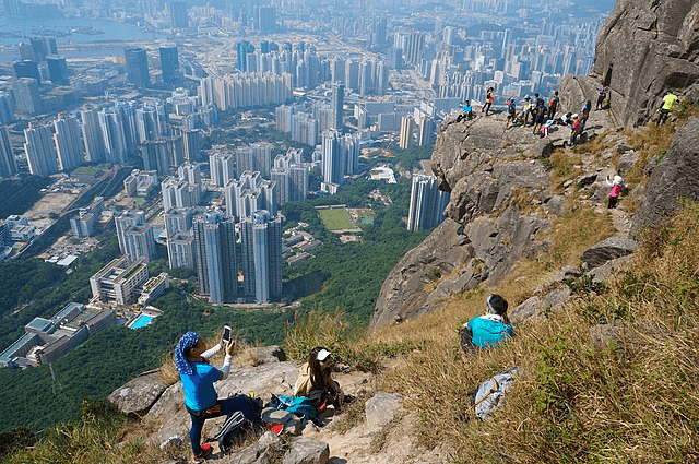
Con 602 m de altura, el pico Kowloon, también conocido como Fei Ngo Shan, es el pico más alto de Kowloon. Forma parte del parque rural Ma On Shan y tiene uno de los acantilados más peligrosos de Hong Kong: el Suicide Cliff. Se llama Suicide Cliff no porque la gente se suicide allí, sino porque los excursionistas resultaron gravemente heridos en el sendero que sube directamente al acantilado. Dicho esto, la caminata hasta Suicide Cliff no tiene por qué ser peligrosa: puedes tomar una ruta más larga y segura hasta Suicide Cliff a través de Kowloon Peak. Hay varias rutas hasta Kowloon Peak, una de las más fáciles es la de Fei Ngo Shan Road. La caminata hasta Kowloon Peak es relativamente fácil y la parte complicada sería la subida desde Kowloon Peak hasta Suicide Cliff, donde las rutas son más estrechas, aunque estarás bien siempre que tengas cuidado y tomes las precauciones necesarias. Desde Suicide Cliff, puedes tomar la misma ruta para regresar a Fei Ngo Shan Road, o continuar por el sendero hasta Sha Tin a través de Elephant Hill.
🗺️ **Ruta: **Carretera Fei Ngo Shan → Pico Kowloon → Acantilado Suicida → Pico Kowloon → Carretera Fei Ngo Shan
🚆 **Cómo llegar: **Desde la estación de MTR City One, tome el minibús 65A o 65K hasta la terminal de autobuses de Wong Nai Tau.
Kau Nga Ling del oeste
🌋 Dificultad: Difícil | Distancia: aprox. 9 km | Duración: aprox. 6 horas
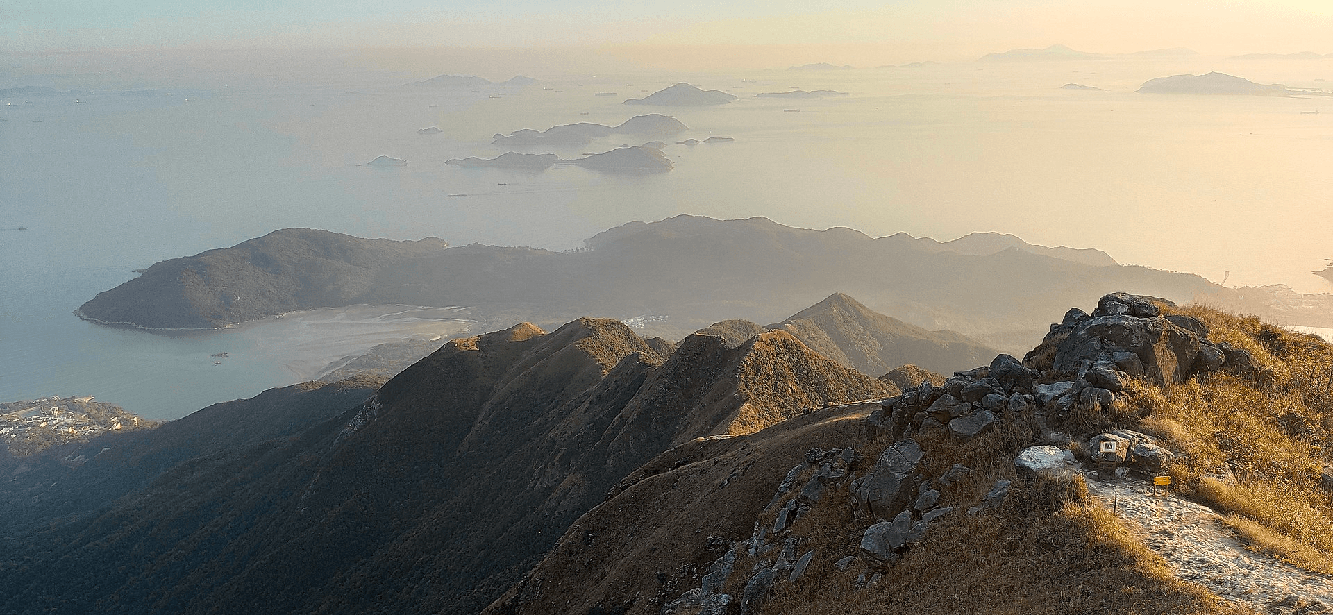
La Kau Nga Ling, que literalmente significa cresta de los dientes de perro, se considera la caminata más difícil de Hong Kong. Como sugiere su nombre, la caminata consiste en picos delgados y afilados que se parecen a los dientes de un perro. Ha sido incluida en la lista del gobierno de Hong Kong de "puntos negros" de senderismo, que son lugares que se deben evitar debido a su peligrosidad. La cresta de los dientes de perro se compone de tres crestas, la cordillera de los dientes de perro medio, la cordillera de los dientes de perro este y la cordillera de los dientes de perro oeste, de las cuales la este es la más fácil y la oeste la más difícil y más empinada. También puede esperar tener que usar sus manos para ayudarlo a trepar rocas a lo largo del camino. Pero por mucho que sea desafiante, también se le prometen excelentes vistas a lo largo del camino. Las tres cordilleras están conectadas y puede elegir recorrer más de una, pero la mayoría de la gente termina su caminata en el pico Lantau.
⚠️ Si no tienes experiencia como senderista, no intentes hacer esta caminata. Considera hacer el sendero del pico Lantau desde Pak Kung Au si quieres subir al pico Lantau.
🚆 **Cómo llegar: **Dirígete a la terminal de autobuses desde la salida B de la estación MTR Tung Chung y toma el autobús 11 o 23 hasta la estación de policía de Shek Pik.
Manténgase conectado con una eSIM Nomad para Hong Kong
No importa a dónde te lleven tus aventuras de senderismo, mantente conectado con unTarjeta eSIM para viajes a Hong Kongde Nomad. Nomad ofreceeSIM de datos asequibles en más de 170 destinos en todo el mundo, —incluido Hong Kong.
Elige entre una variedad de planes de datos locales, regionales y globales, compra e instala tu eSIM de viaje antes de volar y conéctate a una red local en el momento en que aterrices. ¿Te quedas sin datos a mitad de viaje? Simplemente compra un complemento en la aplicación Nomad.
¿Estás planeando un viaje a Hong Kong? Consigue uneSIM de Hong Kongpara mantenerse conectado durante su viaje.